
|
|
Paddle MapsNRPA, in conjunction with the Rhode Island Blueways Alliance, offers two downloadable paddle maps of Narrow River for kayakers and canoeists who want a self-guided tour of the river. These full-color maps include information on places to put in, points of interest and suggested routes for safely for exploring one of the most beautiful waterways in Southern New England. One map shows routes on the Upper and Lower Ponds with access points at Gilbert Stuart and Lacey Bridge. The other map covers lower Narrow River from the Pollack Avenue Boat Ramp to Pettaquamscutt Cove and the Narrows. The maps also include information on the natural and cultural history of the watershed. The maps were produced as part of a Rhode Island Blueways Alliance program enabling watershed organizations throughout Narragansett Bay to showcase paddling opportunities. 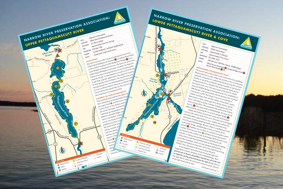 Download Map to put in at Gilbert Stuart Birthplace and Museum or Lacey Bridge to tour the Upper and Lower Ponds. Download Map to explore lower Narrow River including Pettaquamscutt Cove and the Narrows. Check out the paddle maps from other watershed around Narragansett Bay.
|
Remembering
Jon Boothroyd   and a new moon tide combined to raise waters in Narrow River into the parking lot at Middlebridge Marina and flood the marsh just south of Narrow River Kayaks. Photos by Rosemary Smith.")  Follow us
on Facebook  NRPA is a member of the R.I. Rivers Council and has served as the Designated Watershed Council for Narrow River since 2002. NRPA Endowment Fund offers planned giving options
Narrow River Notes
|
